With the delay in monsoon rainfall this year, thanks to El Niño, the unpredictability of weather and climate patterns poses challenges. Yet, as climate change accelerates with these uncertainties, India’s Silicon Valley, Bengaluru, is increasingly battling severe flash floods driven by extreme rainfall events. To counter this growing crisis, researchers from the CSIR Fourth Paradigm Institute and the Academy of Scientific and Innovative Research (AcSIR) have developed a high-resolution hydrological simulation using the United States Environmental Protection Agency’s Stormwater Management Model (SWMM). The study has been published recently in Natural Hazards, a Springer Nature publication.
By constructing a sophisticated “digital twin” of the critically low-lying Koramangala-Challaghatta watershed valley, the team recreated historical deluge events to analyse exactly how stormwater overwhelms the city's concrete infrastructure. Now it is up to the administration to use this model as a predictive decision-support system to forecast inundation zones, optimise drainage capacity, and protect millions of residents from the devastating socio-economic impacts of sudden urban monsoons.
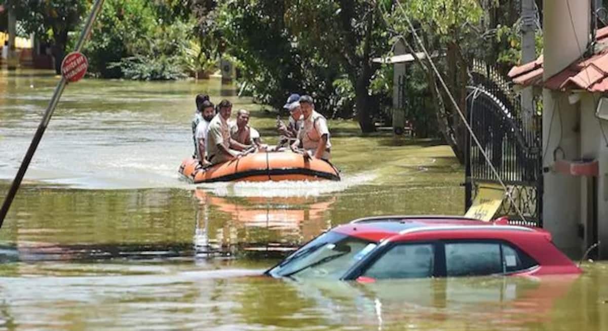
The rapid transformation of Bengaluru from India’s serene garden city into a bustling, concrete-heavy information technology capital has come with a steep environmental price tag. Over the past few decades, the city has been repeatedly paralysed by intense flash floods that submerge streets, strand vehicles, and inundate high-tech business parks. This recurring nightmare is triggered by extreme rainfall events, including sudden downpours where a massive volume of water falls over within a very short period. Because the natural landscape has been systematically paved over, the rainwater has nowhere to go. Instead of percolating naturally into the earth, it surges across impervious roads and rooftops, instantly overwhelming the city’s ageing stormwater drains and pooling into low-lying residential basins. Hence, this situation of flooding in Bengaluru has been described as having been engineered, legally!
To understand and mitigate this crisis, scientists have turned to advanced computational mathematics. The researchers focused their efforts on the Koramangala-Challaghatta valley, or the KC Valley, which spans roughly 299 square kilometres in the south-east part of the city. This specific watershed is a flood-risk zone due to its bowl-like, low-lying topography and its intricate connection to a chain of cascading tanks, including Madiwala, Bellandur, and Varthur lakes. Utilising high-resolution digital elevation maps derived from satellite missions like CARTOSAT and the Shuttle Radar Topography Mission (SRTM), the team mapped the valleys, slopes, and heights of the terrain. They digitally carved the sprawling KC Valley into 39 distinct sub-catchments, each acting as an individual drainage unit with its own unique slope, landcover characteristics, and assigned concrete drainage pathways.
At the heart of this research is the Stormwater Management Model, an advanced physics-based system designed to track water as it moves through engineered urban environments. The researchers have used a modified Green-Ampt infiltration model to simulate both infiltration and evapotranspiration processes within the sub-catchments. The model relies on a sequence of fundamental physical principles, beginning with the conservation of mass to calculate surface water depth over time. It subtracts factors like evaporation and soil infiltration from the total rainfall rate to determine exactly how much water turns into surface runoff. The rate at which this water flows across the city's streets is guided by Manning’s equation, which accounts for the roughness of the ground surface such as concrete versus soil and/or vegetation. Once the runoff plunges into the stormwater network, the model solves the complex, one-dimensional Saint-Venant equations for dynamic wave routing. This mathematical framework allows the simulation to account for water pressure forces and local acceleration, meaning it can realistically replicate backwater effects, pipe surcharging, and localised flooding where drains choke or narrow.
To see if their digital model could hold up in the real world, the scientists gathered granular, hourly data from 26 telemetric rain gauge stations across the city for four notorious historical flood events: September 15, 2015; June 1, 2016; August 15, 2017; and September 24, 2018. Among these, the heavy downpour on 15 August 2017 was particularly overwhelming, with 109.28 millimetres of rain onto the valley within 24 hours. When the researchers fed these historical downpours into their model, the results were remarkably accurate. The simulated peak runoffs perfectly mirrored the actual water surges recorded by the city’s physical water level sensors. The model’s margin of error, or discharge bias, hovered remarkably low at just plus-or-minus four cubic meters per second, proving that it could successfully pinpoint exactly which neighbourhoods would go under water and at what exact hour of a storm.
This research marks a significant evolutionary leap over traditional, static flood modelling methods previously deployed in India. Older hydrological frameworks often relied on generalised regional parameters and simplistic steady-flow assumptions that ignored the complex realities of urban concrete networks. By integrating high-resolution Geographic Information System (GIS) data with dynamic wave routing, this study successfully addresses the historic challenge of scaling fine-grained stormwater physics up to a massive, 299-square-kilometre urban watershed. It captures localised real-time bottlenecks and the unique tank-chain system of Bengaluru, where one overflowing tank spills directly into the next.
However, several limitations remain. The model relies heavily on historical Land Use and Land Cover (LULC) data from Landsat-7 satellite imagery. In rapidly evolving Indian cities, construction happens at a pace that can render a year-old land-use map obsolete, potentially underestimating current concrete coverage. Furthermore, the simulation assumes that stormwater channels are completely clean and structurally sound. In reality, many urban drains across India are partially choked with solid plastic waste, silt, and domestic debris, meaning the actual carrying capacity in a storm could be much lower than the model predicts.
However, implementing this advanced modelling system provides immediate, tangible benefits to urban society. Rather than reacting blindly after a disaster has struck, the city corporations under the Greater Bengaluru Authority (erstwhile Bruhat Bengaluru Mahanagar Palike, BBMP) can utilise these simulations as a proactive decision-support tool. By running real-time weather forecasts through the calibrated model, city administrators and engineers can receive a multi-hour head start to deploy emergency response teams, position water-pumping machinery, and safely evacuate residents from low-lying, flood-prone blocks before the first drop of rain even hits the pavement.
In the long-term, the model acts as an invaluable guide for sustainable urban planning and investment in resilient infrastructure. It tells engineers exactly which specific concrete channels are under-designed and need widening, preventing the wastage of public funds on arbitrary drain expansion. Furthermore, the model can simulate the benefits of green infrastructure, allowing planners to test how implementing rainwater harvesting, permeable pavements, and urban parks can reduce the stress on the city's drainage grid. Ultimately, this science protects human lives, preserves property value, and saves crores of rupees in avoided economic disruptions.



