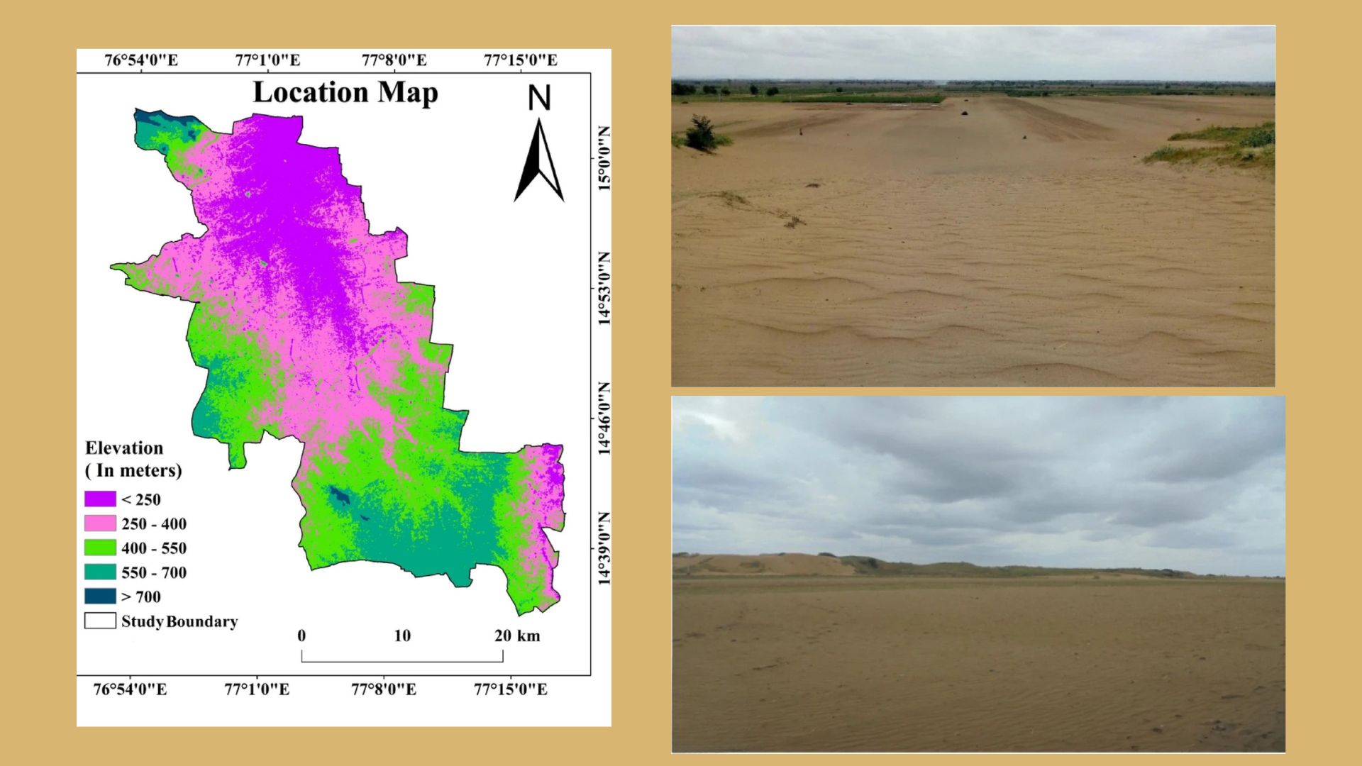
A new study has identified approximately 192 square kilometres of severe land degradation and desertification in the Anantapur district of Andhra Pradesh. By analysing thirty years of satellite imagery from 1990 to 2020, a team of researchers from CSIR-National Geophysical Research Institute, Yogi Vemana University, and Government College (Autonomous), Anantapur, mapped how migrating wind-blown sand and human activities are slowly turning once-productive agricultural lands into desert hotspots. The findings provide a crucial early warning system for a region already battling erratic rainfall and recurrent droughts.
Anantapur district is particularly vulnerable to climate extremes as it sits in the rain shadow of the Western Ghats, a region where the rain-bearing clouds are interrupted by the towering landmass of the Ghats. This new mapping effort tries to explain where the landscape is breaking down and why it is happening. To map the environmental decline, the scientists turned to orbital satellites.
They analysed multi-decadal data from NASA's Landsat missions to track four specific indicators of land health. First, they looked at vegetation cover to see where plant life was struggling or dying out. Second, they measured surface temperature, which naturally spikes as cooling plant cover disappears and bare ground is exposed to the sun. Third, they mapped the grain size of the topsoil to track the movement of coarse, wind-blown sand dunes. Finally, they measured soil salinity, because salt buildup makes it incredibly difficult for crops to grow.
By combining these four indicators over a thirty-year timeline, the team observed that surface temperatures were steadily climbing, vegetation was vanishing, and the soil was becoming coarser and saltier. The root of this physical transformation, the study found, traces back to an extreme flash flood on the 5th of May, 1851, which dumped massive sheets of loose river sand along the Hagari River. Over the last century, strong southwest monsoon winds have whipped these historical deposits into migrating sand dunes that slowly bury modern farmlands.
By developing a unified framework that simultaneously evaluates vegetation, soil texture, salinity, and thermal data across multiple decades, the researchers have achieved a much more accurate and comprehensive assessment of the environment in Anantpur. This integrative method allows scientists to confidently separate temporary seasonal droughts from permanent, long-term desertification. However, the researchers note that because the Landsat satellites capture images at a medium resolution of thirty metres per pixel, very fine-scale, localized degradation might slip under the radar. Additionally, taking data snapshots once a decade might miss rapid, short-term seasonal changes in soil moisture and plant health.
Despite the constraints, this mapping technique offers an improved method of identifying and mapping desertification hotspots. This allows local governments, farmers, and conservationists to intervene before the land becomes entirely barren. By knowing exactly where to plant protective tree barriers, regulate sand mining, and promote water-saving farming techniques, authorities can halt the expanding desert and protect the livelihoods and food security of millions of people living in vulnerable, semi-arid regions across the globe.



