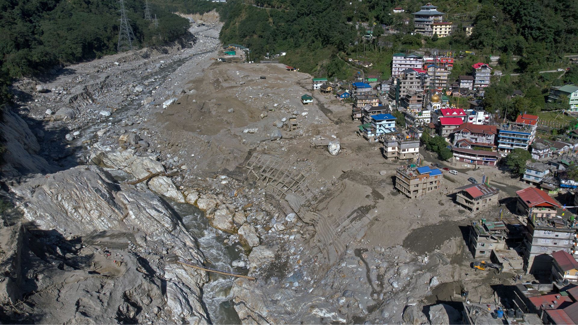
On October 4, 2023, the South Lhonak lake in the Indian state of Sikkim triggered a devastating Glacier Lake Outburst Flood (GLOF), claiming 24 lives, leaving dozens missing, and destroying vital infrastructure. A new study published in Scientific Reports has now provided a definitive timeline of the events that led to this disaster, offering critical insights for preventing similar future tragedies. By utilising advanced satellite imagery and geomorphological modelling, researchers determined that the flood was not caused by heavy rainfall or seismic activity, as some had initially suspected, but rather by a compound geological process involving a major landslide and the rapid retreat of the adjacent glacier.
The research team included researchers from the Wadia Institute of Himalayan Geology, the Institute of Science and Technology Austria, Cornell University, USA, Gangneung-Wonju National University, Korea, CSIR-National Geophysical Research Institute, and the Singapore MIT Alliance for Research and Technology, Singapore. They performed an exhaustive analysis of the region using Sentinel-1 and Sentinel-2 satellite data. Their methodology involved monitoring ground subsidence and morphological changes around the lake area leading up to the disaster. They discovered that the South Lhonak glacier had retreated by over 100 meters between February and September 2023, which left behind unstable dead ice along the lake's left lateral moraine. Furthermore, melting snow and runoff from upstream streams had seeped into this structure, gradually weakening it.
The tipping point occurred on October 4, when a massive landslide dumped approximately 38.31 million cubic meters of debris into the lake. This sudden influx triggered a secondary collapse, causing an additional 7 million cubic meters of ice from the glacier to calve into the water. The combined displacement of nearly 45 million cubic meters of material generated massive, impulsive flood waves that breached the lake’s terminal moraine dam, resulting in the catastrophic downstream flood. The researchers explicitly ruled out seismic activity as a cause, noting that recent earthquakes in the region were too weak to have triggered such a structural failure.
By investigating the specific sequence of events, the landslide, the ice calving, and the geological instability, it paints a complete picture of the events that led to the devastation. However, the team noted that the lack of in-situ (on-the-ground) measurements of glacier velocity and surface subsidence forced them to rely on satellite-derived estimates and established models, which carry inherent margins of uncertainty.
Nonetheless, by identifying that rapid glacier retreat, lateral moraine instability, and subsidence are the primary warning signs of Glacial Lake Outburst Floods (GLOFs), the researchers have provided authorities with a clear, science-based recommendation for the future. Continuous, long-term monitoring of these specific environmental indicators at high-altitude lakes is essential to providing early warnings and potentially saving thousands of lives and billions in infrastructure costs across the vulnerable Himalayan region.



