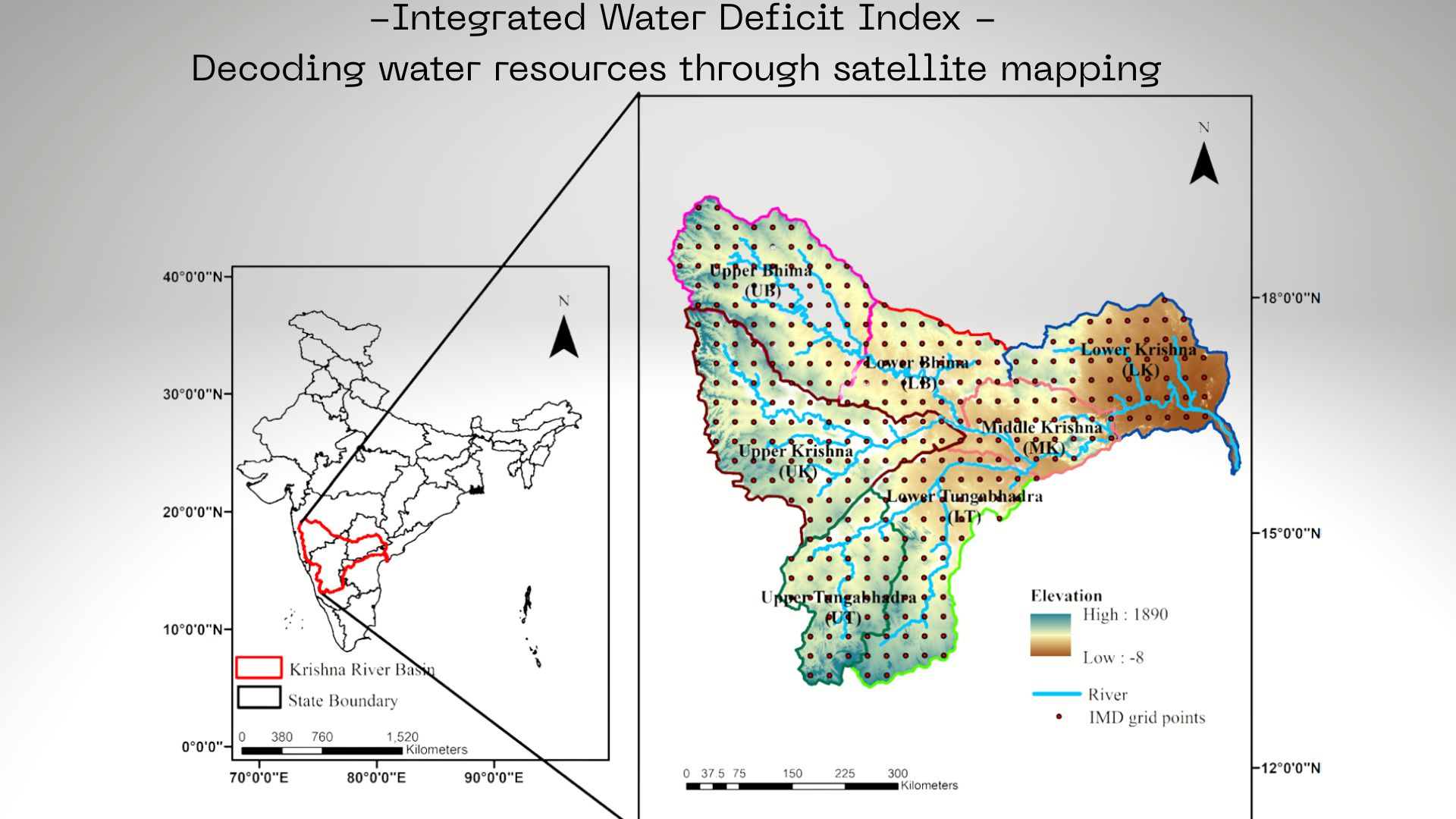
Engineers from the Indian Institute of Technology (IIT) Hyderabad have developed a new method to measure and track droughts. By combining satellite data on weather and underground water reserves, researchers Sai Srinivas Gorugantula and BVN P Kambhammettu created the Integrated Water Deficit Index (IWDI) to study exactly how droughts develop and how regions recover.
The researchers set out to improve traditional ways of measuring droughts, which were failing to capture the full picture of water scarcity in large, dry regions. To create a comprehensive index, they looked at two main pieces of the water puzzle. First, they measured climatic water, which is the amount of rainfall received minus water lost to evaporation. Second, they looked at terrestrial water storage, which includes all the physical water stored in the environment, such as rivers, soil moisture, and deep groundwater.
They relied on data from local weather stations alongside satellite systems like Gravity Recovery and Climate Experiment (GRACE), a joint mission of NASA and the German Aerospace Center. GRACE measures changes in Earth's gravity to detect underground water. The team then merged these two massive datasets using a mathematical function called a Clayton copula. This statistical method calculates the joint probability of two events occurring simultaneously. The team then used this merged dataset to build the IWDI, enabling them to see what happens when a lack of rainfall coincides with empty underground reservoirs.
When applied to the Krishna River Basin, a vast area that provides water to millions of people across four Indian states, the tool uncovered clear patterns. It shows that recent dry spells slashed crop production by 25% and reduced the volume of vital water bodies by 15% between 2002 and 2017. The researchers found that the higher elevation areas of the basin suffered from prolonged, severe droughts that took more than a year to fully develop and just as long to recover from. Conversely, the lower areas of the basin experienced frequent but much shorter dry spells. They also discovered that while a lack of rain kicks off a drought, high temperatures and evaporation are the primary culprits that make it significantly worse.
By capturing both the weather above ground and the physical water stored below, this new index provides a much more accurate and holistic representation of extreme drought events that older models missed. However, the researchers note that their new system struggles to accurately map the exact speed at which short, seasonal droughts develop and recover due to false recovery events, such as a sudden but brief downpour that temporarily interrupts a dry spell. They acknowledge that future studies will need data with a much finer time resolution to understand these seasonal quirks and to track rapid changes more precisely.
As climate change increases the frequency of severe dry spells, understanding exactly how water resources deplete and recover is crucial for human survival. This new index gives governments, reservoir managers, and farmers the foresight they need to manage precious water supplies, plan emergency agricultural strategies, and ultimately protect millions of vulnerable people from the devastating impacts of famine and drought.



