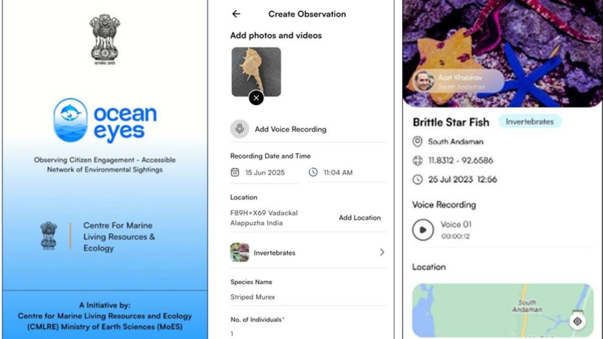
In a bid to improve marine research, researchers have launched a novel mobile application called OceanEyes, designed to turn ordinary citizens into ocean explorers. Developed by the Centre for Marine Living Resources and Ecology under the Ministry of Earth Sciences, Government of India, the app aims to solve a massive blind spot in our understanding of ocean life. Although oceans cover 70% of our planet, the majority of marine species remain undiscovered or poorly documented, especially in tropical regions like the Indian Ocean. Between late 2023 and early 2026, researchers rolled out this new tool to help coastal communities, fishers, and nature enthusiasts log sightings of marine animals across India's vast marine zones. By crowdsourcing this information, scientists hope to build a massive, high-resolution database of marine life to track climate change and protect vulnerable ecosystems.
OceanEyes relies on citizen science, where public participation is used to gather scientific data. The team used an Agile software development method, which means they built prototypes, tested them with marine biologists and volunteers, and constantly tweaked the design based on their feedback. Because the app needs to work out on the water, they engineered it to capture photos, videos, and audio even when there is no cellular signal. Once the user's phone reconnects to the internet, the data automatically uploads to a central server. To ensure that the data collected by citizens remains useful for research, it goes through a strict two-tier validation process before any sighting is officially added to global scientific databases. Marine taxonomists manually review submitted images and GPS data to ensure correct species identification and data integrity, thereby filtering out errors.
While global citizen science platforms like iNaturalist and eBird have been incredibly successful at gathering environmental data, they are largely biased toward land animals and birds, lacking the specific data fields needed for marine ecology. Earlier attempts to develop regional apps in India focused on very narrow topics, such as rescuing stranded marine mammals or logging commercial fishing catches. OceanEyes improves on this by allowing users to record highly specific marine details, such as ocean depth and seabed type, for a wide variety of ocean life. It also formats this data to feed directly into the Ocean Biodiversity Information System, a major global scientific database.
The researchers, however, acknowledge that the expert validation process meant to improve accuracy creates a severe scaling bottleneck, as scientists must manually review every single submission. Furthermore, while the app works offline, people naturally tend to report sightings from easily accessible coastal zones rather than remote offshore waters, creating a spatial bias in the data. The researchers also noted that differences in smartphone camera quality and GPS accuracy can affect the reliability of the reports, and their initial usability testing was limited to a relatively small group of users.
Despite this, OceanEyes equips citizens with the tools to map their local waters, democratising scientific research and expanding the reach of traditional scientists. This grassroots data could help policymakers and conservationists make better decisions about marine spatial planning, track how climate change is shifting species' habitats, and monitor life below water. More importantly, the app provides a useful tool for common citizens to learn more about the vast biodiversity lurking in our oceans.



