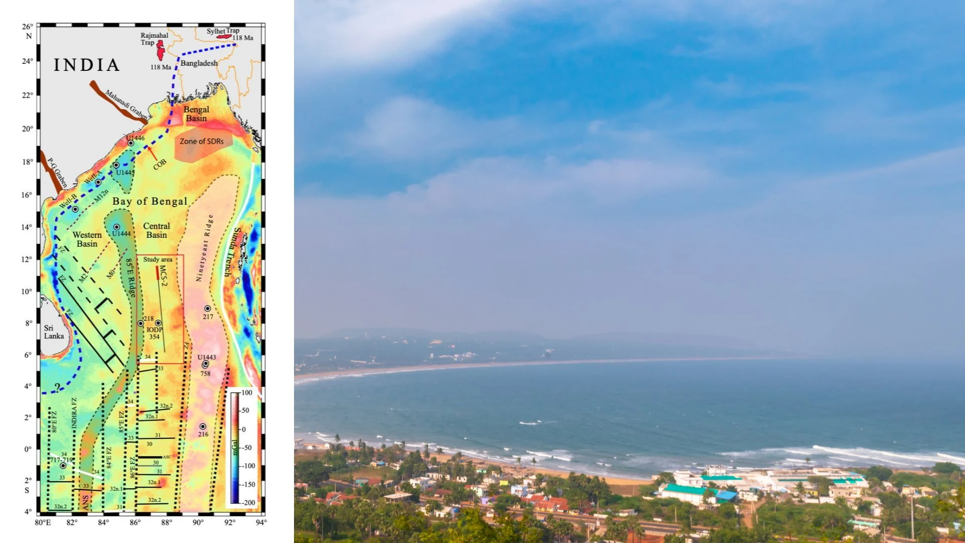
Researchers Mohammad Ismaiel and Kolluru Sree Krishna from the Indian Institute of Science Education and Research (IISER) Pune have, for the first time, successfully dated the deep ocean floor beneath the central Bay of Bengal to exactly 92 million years ago. Their new study solves a decades-old geological puzzle regarding the tectonic evolution of the Indian Ocean. The researchers analysed ancient magnetic signatures trapped in rocks buried beneath miles of ocean sediment, revealing clues about the timeline of the Indian subcontinent breaking away from Antarctica.
Determining the exact age of this oceanic crust is a major challenge for geologists due to a unique combination of extreme geological events. Normally, scientists date the ocean floor by looking at magnetic stripes. As magma rises from the Earth's interior and solidifies into new crust, magnetic minerals within the rock align with the Earth's magnetic field. Because the Earth's magnetic north and south poles flip periodically, the ocean floor acts like a giant, slow-moving tape recorder, creating a barcode of magnetic reversals that scientists can read.
However, the crust beneath the Bay of Bengal was formed during a bizarre geological era known as the Cretaceous Normal Superchron, a stretch between 120 and 83 million years ago when the Earth's magnetic field stubbornly refused to flip. To make matters even more difficult, this ancient crust was heavily scarred by intense volcanic activity and is currently buried under the Bengal Fan, a colossal pile of sediment up to 18 kilometres thick that eroded off the Himalayas.
To bypass these obstacles, the researchers had to look for a different kind of signal. Instead of looking for changes in magnetic direction, they searched for an internal time marker known as Q1. This marker records a brief, globally recognised fluctuation in the actual strength of the magnetic field, rather than a full pole reversal. The team collected data using research ships towing magnetic sensors, and compared it with satellite models and seismic reflection imaging, which uses sound waves to map deep underground structures. This allowed them to successfully pinpoint the faint Q1 signal. They located it at around 12 degrees north latitude, situated between two massive underwater mountain ranges known as the 85°E and Ninetyeast ridges.
Previous geological models could only estimate the broad timeframe of the region's formation due to the lack of magnetic barcodes. While earlier studies had successfully found these field strength markers in the Atlantic Ocean, this is the first time the Q1 marker has been confidently identified in the Bay of Bengal, providing a definitive timeline for major tectonic plate shifts in the Indian Ocean.
The researchers had originally hoped to find a second, older time marker known as Q2, dating back 108 million years. However, they were unable to clearly detect it in their data. They suspect the original magnetic signature of Q2 was masked or altered by intense volcanic activity in the area, or that its signal was simply too stretched out to read clearly. The authors note that higher-resolution geophysical surveys will be required in the future to clear up these uncertainties.
Nevertheless, tracing the exact tectonic history of the northeast Indian Ocean will help in completing the deeply fragmented puzzle of our planet's tectonic history. By successfully establishing a definitive age constraint of 92 million years for the crust beneath the Bay of Bengal, scientists can now refine their geophysical models of how the ancient supercontinent of Gondwana broke apart. Specifically, it provides a much clearer timeline of the complex plate reorganisations that occurred as the Indian subcontinent rapidly separated from Antarctica and migrated northward. It also helps in understanding the deep, dynamic forces that have shaped the Earth's surface over millions of years.



